Full page view of interactive map
Cartography by Maia Wachtel, Marcea Ennamorato and Brittany Burson // UC Berkeley CAGE Lab. Map by Amanda Hickman, with research by Lulu Orozco // Public Press.
The Bay Area’s current boom times represent a good news/bad news story. From Dogpatch to San Mateo to Alameda, bayside property is especially desirable — but increasingly complicated. Although Bay Area planners have in recent years elevated the role that sea level rise projections play in the permitting and design process, cities are still under pressure to approve more development quickly on under-used land.
Perhaps, while sitting in traffic during that ever-congested commute, you’ve taken note of the skyline filled with cranes. Builders are in a frenzy as they attempt to meet the region’s demand for office space and housing.
The Bay Area has outpaced the rest of the state and country in economic growth for each year since 2011, according to the U.S. Bureau of Economic Analysis. But only 94,000 new housing units were permitted in the region between 2011 and 2016, despite the addition of 530,000 jobs, the Building Industry Association of the Bay Area found. Over the past decade, as housing prices have escalated, residents have looked farther afield for affordable homes, contributing to a 27-minute increase in average daily commutes, according to the 2016 Silicon Valley Index.
A 2015 analysis by the Public Press found that Bay Area builders were investing more than $21 billion in 27 large waterfront projects at less than 8 feet above high tide. That elevation could see occasional flooding by the end of this century.
Since then, developers have crafted plans for another eight large-scale commercial and residential construction projects in that zone. Though not all amounts are yet known, we have tallied more than $1.8 billion in costs associated with buying land parcels and building these proposed projects.
Regionally, policies guiding sea level rise adaptation and design continue to be inconsistent. Of the new and in-progress waterfront developments, some failed to include any proposals to mitigate future flooding.
For other projects in the permitting and approval process, rising water is a principal design consideration.
But adaptation is not cheap. The firm planning to redevelop the Alameda Marina, for instance, will spend $44 million to make the 13-acre site resilient to sea level rise and storm surges by rebuilding degraded sections of the landing and erecting a seawall.
In part because long-term forecasting of future climate change is inherently imprecise, the exact amount of sea level rise that Bay Area communities are planning for varies greatly. Most agencies are using 2012 projections by the National Research Council, which predict a rise of anywhere between 3 and 4.6 feet by 2100 — enough to permanently flood the Ferry Building at the foot of Market Street, for example — not counting the possibility of 3.4 feet of surging water during extreme storms.
The Bay Conservation and Development Commission has very limited jurisdiction over the Bay shoreline, from the water’s edge to just 100 feet inland. The regional agency requires developers to use climate change projections to assess the risk of structures being flooded by 2050.
“We advise people to be conservative,” said Brad McCrea, regulatory director for the commission. “It’s easier to build for high water now rather than respond to it later.”
But an uptick in the melting of the Antarctic ice fields means that earlier projections could be low. State law does not provide any hard numbers, and developers can pick conservative estimates as long as the science has been peer-reviewed. Bay Area planners are watching this closely.
Until recently, developers had to complete vulnerability checks as part of the California Environmental Quality Act review process. The assessment included future flooding from rising water levels.
But in 2015, a California Building Industry Association lawsuit challenged these standards and the state Supreme Court ruled that climate change was beyond the limited scope of these state environmental rules.
Our map shows planned construction projects. In many of these vulnerable areas, cities are encouraging new construction with special zoning and tax incentives.
To compare other sea level rise outcomes — including a 3-foot rise in sea level (considered by scientists the “most likely” scenario for 2100) — download a pdf of the map from our print edition, or order a copy of the newspaper.
NEW MAJOR PROJECTS, April 2017
These eight megadevelopment projects, with a known cost of more than $1.8 billion, are in areas vulnerable to rising floodwaters on the edge of San Francisco Bay, join 27 we assessed in 2015.
Redwood Landfill
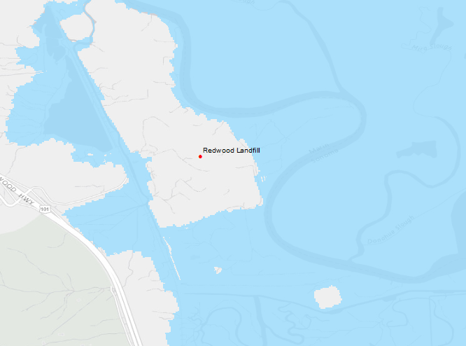
Photo courtesy of Strada Investment
WHAT: 420 acres, landfill, recycling and compost facility | WHERE: Novato | STATUS: Legal challenge denied | DEVELOPERS: Waste Management | COST: $39.6 million | INCLUDES: Project cost estimate (for a new energy plant on the premises), land value
In 2006, a group of North Bay residents raised red flags over developer Waste Management’s interest in expanding its 420-acre landfill and recycling facility. After Marin County certified the project’s 2008 environmental impact report, the group sued the county in part because of what it called an inadequate plan for adapting to sea level rise. Under the plan, every five years the facility’s operators are to assess, using the latest scientific projections, whether levees surrounding the property are tall enough to prevent ocean waters from flowing in, carrying waste to San Pablo Bay. Per this plan, Waste Management raised a levee once, in 2008, said Rebecca Ng, the county’s deputy director of Environmental Health Services. Waste Management did not respond to a request for comment.
Richmond Terminal One
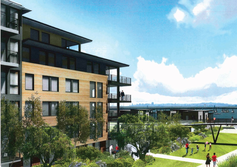
Artist rendering of Richmond Terminal One. Courtesy of Terminal One Development
WHAT: 13 acres, residential with public trail and park | WHERE: Richmond. | STATUS: Construction to begin late 2017 | DEVELOPERS: Terminal One Development and Laconia | COST: $14 million | INCLUDES: Land value, fees
This project will entail 21 single-family homes, as well as five condominium buildings containing a total of 295 flats, on a former oil- and gas-storage facility next to the Richmond Yacht Club. To adapt to a projected 3-foot increase in sea level and to mitigate storm damage, the buildings will be set inside the Bay Trail, to be built at nearly 11 feet above current sea level.
Pier 29, Embarcadero
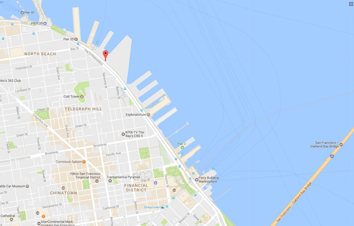
WHAT: Approximately 20,000-square-foot commercial development, within 123,000- square-foot pier | WHERE: San Francisco | STATUS: In approval process | DEVELOPERS: Jamestown | COST: $5.8 million | INCLUDES: Project cost estimate
This pier, on San Francisco’s Embarcadero, was built in 1915 and was to be used as an event space for the 34th America’s Cup before a fire damaged the structure in 2012. It has been rebuilt and the Port of San Francisco is negotiating a lease with developer Jamestown to add commercial space to its bulkhead, which is one-fifth of the total building site. The Sierra Club and other groups have objected, saying the space should be for recreational purposes, but the city said it needs the tax revenue it would receive through the planned use. The Port of San Francisco, which owns the land, will work with the developer to make an adaptation plan for future sea level rise, said Port Commission spokesperson Renée Martin.
75 Howard St.
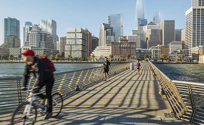
Artist rendering of the 75 Howard St. project from a pier. Courtesy of the Paramount Group
WHAT: 4-acre lot, residential tower | WHERE: San Francisco | STATUS: Permits granted, demolition of current structure to start soon | DEVELOPERS: Paramount Group | COST: $218.6 million | INCLUDES: Project cost estimate, land value, fees
When finished, this 21-story tower will contain 120 luxury condominiums as well as street-level commercial space. The project’s environmental impact report notes that, based on current projections, the bottom floor of the building will likely be inundated during a 100-year-flood event by 2050. But developer Paramount Group faces no legal mandate to adapt the design to future sea level rise because the property lies outside the jurisdiction of the Bay Conservation and Development Commission, which requires risks associated with sea level rise to be assessed. Paramount declined a request for comment.
Former Potrero Power Plant
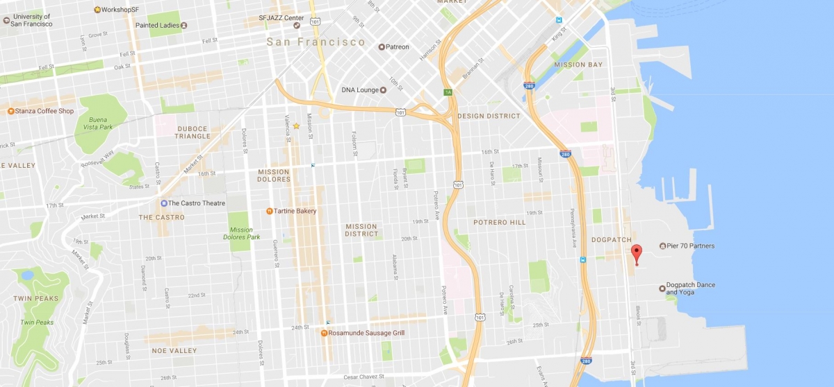
WHAT: 1201 Illinois St. | 21 acres, mixed-use development | WHERE: San Francisco | STATUS: In approvals, land remediation phase | DEVELOPERS: Associate Capital | COST: $71.5 million | INCLUDES: Land value (partial amount)
This property is owned by Associate Capital, an investment group that includes eBay’s Meg Whitman. Real estate developer District Development is remediating toxic soil at the site of this former power plant, as a first step to converting it to 3 million square feet of housing and commercial space, plus public waterfront access. The developer has not yet submitted plans for the site, said spokesman P.J. Johnston, but it will “conform to existing and new planning requirements” around sea level rise.
Brisbane Baylands
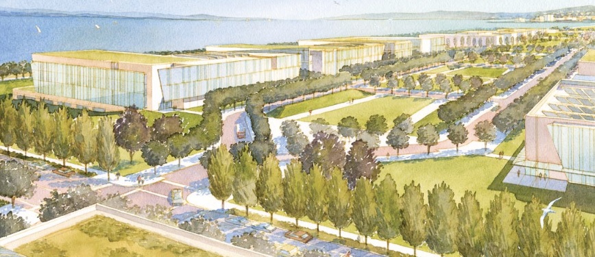
Artist rendering of Brisbane Baylands development. Courtesy of Universal Paragon Corp.
WHAT: 684 acres, mixed-use development | WHERE: Brisbane | STATUS: City reviewing project through June 2017 | DEVELOPERS: Universal Paragon Corp. | COST: $1.37 billion | INCLUDES: Project cost estimate, associated infrastructure costs
Since 2006, developer Universal Paragon Corp. has been advancing this massive proposal to replace a defunct rail yard and landfill with 4,000 housing units, a large park, and 7 million square feet of commercial space. Some Brisbane residents oppose the plan due to concerns over congestion, but SPUR, a Bay Area urban planning think tank, and other smart-growth proponents endorse it because it would provide dense housing and access to nearby Caltrain, SamTrans, and Muni buses and trains. If approved, construction could start in 2019 and take up to 20 years.
Tidelands Condominiums
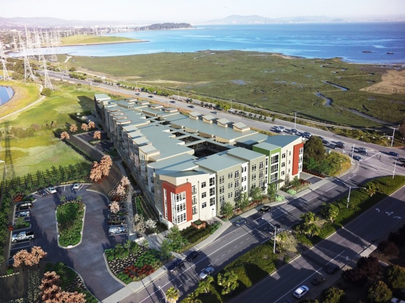
Artist rendering of Tidelands Condominiums development. Courtesy of the New Home Company Inc.
WHAT: 2.8 acres, 76 condominiums | WHERE: San Mateo | STATUS: Completed, October 2016 | DEVELOPERS: The New Home Company | COST: $42.6 million | INCLUDES: Project cost estimate (construction only), land value
This 76-condominium project resulted in the removal of one-third of an acre of seasonal wetlands, and the developer, which declined to comment for this story, made up for that by buying credits meant to finance wetland restoration elsewhere. The developer also added two landscape features, called bioswales, to remove pollutants from runoff into adjacent wetlands. The structures were not designed to accommodate rising sea levels.
Alameda Marina
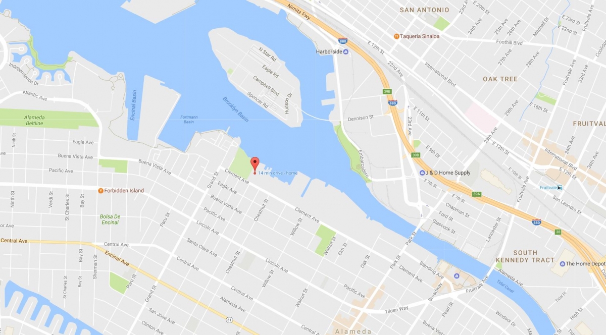
WHAT: Redevelopment Proposal 44 acres, mixed-use redevelopment | WHERE: Alameda Master | STATUS: Plan submitted, in approval phase |DEVELOPERS: Bay West Development COST: $44 million | INCLUDES: Site improvements (to prep land for construction)
Almost 90 percent of the Alameda Marina is still undeveloped. This project would fill much of that open space by adding about 670 residential units and 200,000 square feet of commercial space, reconstructing the shoreline in the process. The developer has said it will build seawalls to shield the property from at least 24 inches of projected sea level rise, per the city of Alameda’s requirements. Its design accommodates future adaptive measures, such as increasing the seawall height above that level, according to the project plan.
The first San Francisco Public Press survey listed the following 27 major real estate developments proposed, planned or underway around San Francisco Bay that would be vulnerable to severe flooding due to climate change. Their known cost is more than $27 billion (as of 2015).
Mission Bay
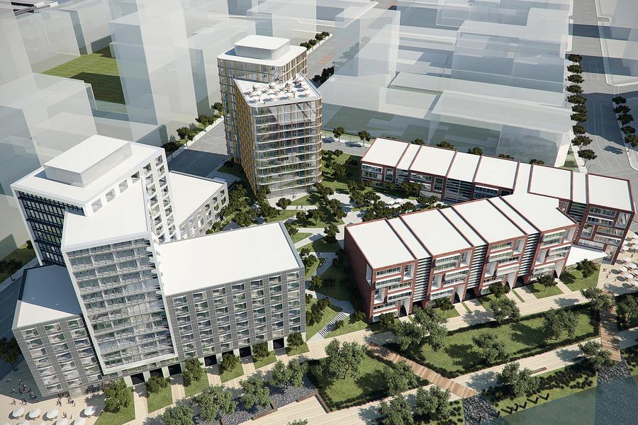
Photo courtesy of Strada Investment
WHAT: 2.2-acre mixed-use development | WHERE: San Francisco | DEVELOPERS: CIM Group | STATUS: Scheduled to open Fall 2017 | COST: Undisclosed
The Mission Bay neighborhood continues to transform into a mixed-use development with One Mission Bay — a 350 luxury residential project, with 41,000 square feet of resort-style amenities, 16,000 square feet of retail space, and 348 parking spaces. The projects consist of two towers: one 198-unit, 16 story high-rise, and a 152-unit, seven-story building. CIM Group is the owner and developer of the project site, while Strada Investment remains CIM’s representative.
Central Waterfront
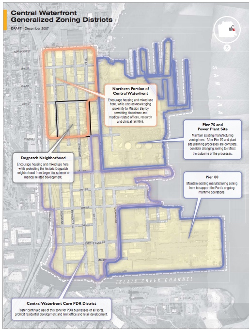
Photo courtesy of the City and County of San Francisco Planning Department
WHAT: Mixed-use development | WHERE: San Francisco | DEVELOPERS: Many | STATUS: Still in planning phases| COST: Not set
The Central Waterfront Neighborhood would stretch about 500 acres along the city’s eastern shoreline between Potrero Hill and the bay. Long-term plans include Pier 70’s 28-acre, mixed-use development. The environmental impact report states that city Public Works hydraulic engineers will review building permits to suggest improvements “on a project-by-project basis to ensure that properties are removed from risk of flooding.
Pier 70
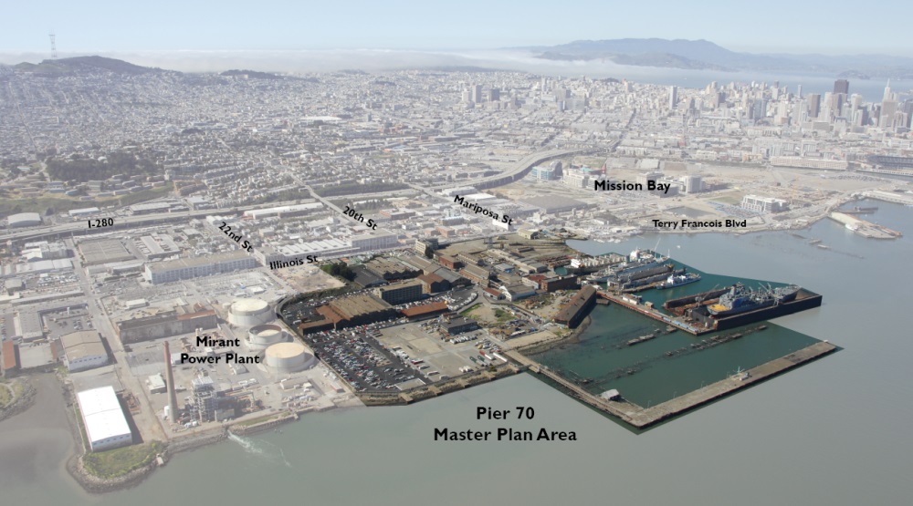
Photo courtesy of Pier 70: A Forest City Project
WHAT: 28-acre mixed-use development | WHERE: San Francisco | DEVELOPERS: Forest City | STATUS: Seeking approvals Summer 2017 | COST: $2 billio
The historic district in the Dogpatch neighborhood will get between 1,100 to 2,150 housing units, 30 percent of them designated “affordable.” Includes between 1 million and 2 million square feet of office space, 500,000 square feet of retail, arts and light industrial space, in addition to 9 acres of open space. New building heights range from 50 to 90 feet. Historic buildings would be rehabilitated. DEVELOPERS to seek project approvals in 2017 from the San Francisco Port Commission, San Francisco Planning Commission and the San Francisco Board of Supervisors
According to Forest City, sea level rise projections are based on the high end of state guidelines for 2100 and there is a financing mechanism to fund future improvements for sea level rise. Protections involve raising the grade of the entire site to elevate buildings and ensure that utilities function properly. With improvements, Pier 70 can coexist with higher tides and storm surges. Many of these protections will be part of creative designs that maximize shoreline access for public use. The Pier 70 project includes a Community Facilities District financing mechanism that generates revenue long after the project is built to fund future sea level improvements, if needed
Executive Park
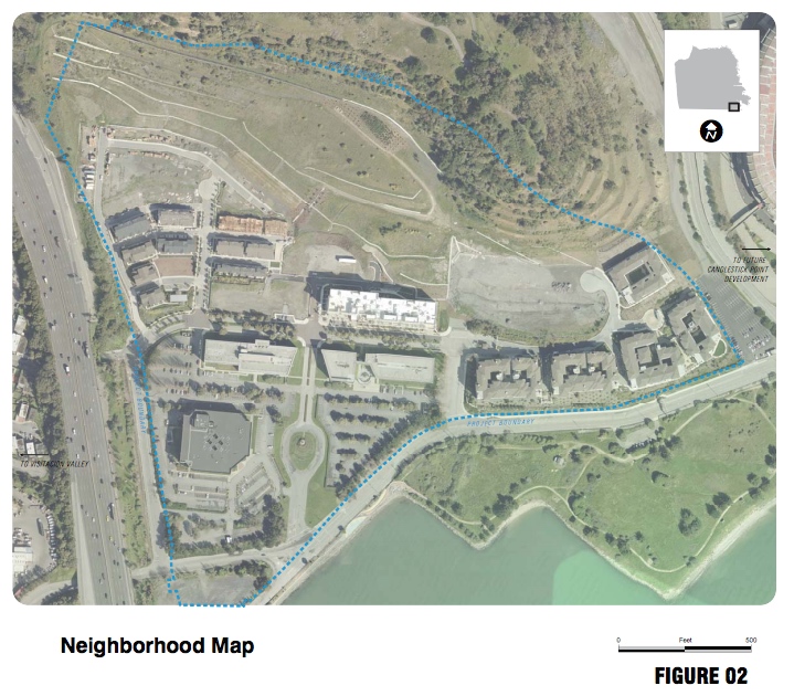
Photo courtesy of the City and County of San Francisco Planning Department
WHAT: 14 acres, mixed-use development | WHERE: San Francisco | DEVELOPERS: Yerby Co., Universal Paragon Corp., others | STATUS: In planning phases| COST: Undetermined
The Executive Park subarea plan, which would create a new residential neighborhood east of Highway 101, includes two projects: the Yerby Company and the Universal Paragon Corp. The Yerby Project, renamed the Thomas Mellon Waterfront Residences, was approved Dec. 1, 2016, and has been expanded from 500 to 583 residential units. The Universal Paragon Corp. project has not yet submitted an application for its portion but is expected to do so soon. The draft environmental impact report relies on a predicted sea level rise of 3 feet by 2100, which does not include storm surge and is at the low end of projections.
Golden State Warriors Arena
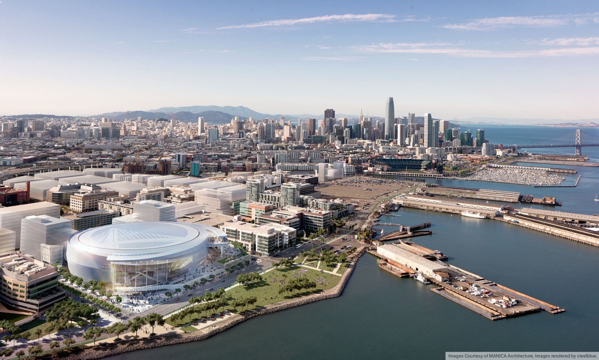
Photo courtesy of MANICA Architecture, images rendered by steelblue
WHAT: 12-acre sports complex | WHERE: San Francisco | DEVELOPERS: Golden State Warriors | STATUS: To open during the 2019-20 NBA season | COST: Estimated $1 billion
The team broke ground in January 2017 on the Chase Center, a state-of-the-art sports and entertainment complex in Mission Bay. The 135-foot-tall arena will feature 18,064 seats for basketball games, with a maximum concert capacity of 18,500. The development will include 100,000 square feet of retail, restaurants, cafes and public plazas, in addition to a new 5½-acre public waterfront park. The arena is reportedly the only privately financed facility of its kind in the United States. A final environmental impact report has not been released yet, but the draft environmental report states that the “planʹs effects related to flooding and sea level rise would be less than significant.
India Basin
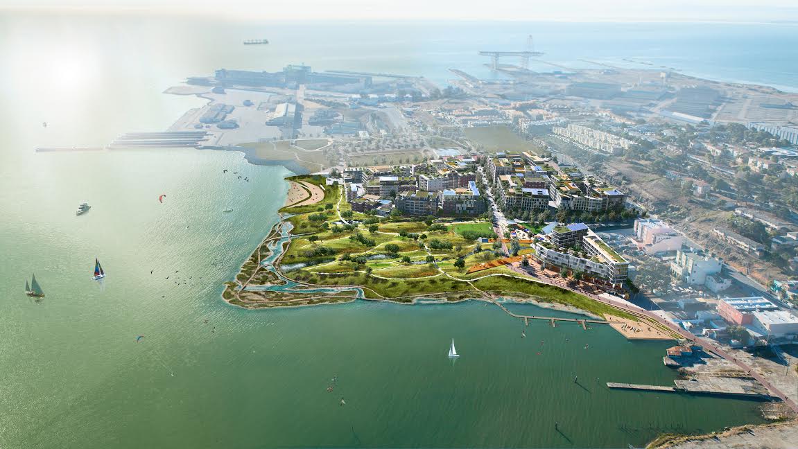
Photo courtesy of Build Inc
WHAT: 15.5-acre mixed-use development | WHERE: San Francisco | DEVELOPERS: Build Inc. | STATUS: Seeking approval in 2017 | COST: $800 millio
The project, adjacent to the India Basin Shoreline and 900 Innes — a separate city-owned parcel that will become a park — could be developed with up to 1,240 apartments, 275,000 square feet of retail and commercial space, plus a 50,000-square-foot K-8 public school. Traversed by 13-mile Blue Greenway bay trail, the project and all major infrastructure would be situated at higher elevations, DEVELOPERS said, and would accommodate the current worst-case projections for sea level rise in 2100 — 69 inches, including 100-year storm conditions. DEVELOPERS added that the site would also be able to accommodate higher projections. The shoreline is specifically designed to adapt and allow for upland habitat migration and enhanced ecologies in future sea level rise conditions
S.F. State University

WHAT: Satellite campus | WHERE: San Francisco | DEVELOPERS: Lennar Urban | STATUS: Exploratory | COST: Undetermined
A university spokesperson said the school is still considering opportunities to establish an S.F. State presence in Bayview-Hunters Point.
Mission Rock
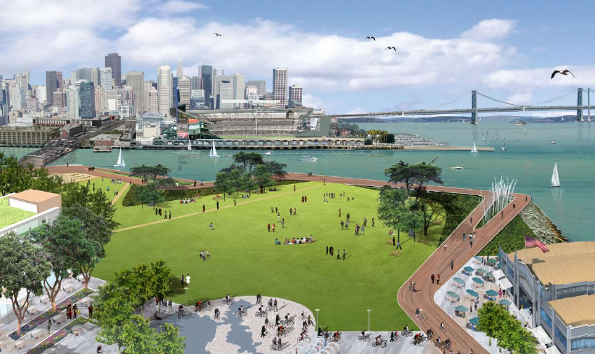
Photo courtesy of The Cordish Companies
WHAT: 28 acres, mixed-use development | WHERE: San Francisco | DEVELOPERS: Giants Development Services | STATUS: Construction starts 2017 | COST: $1.8 billion (estimated)
In November 2015, 74 percent of voters approved Proposition D, which raised the height limit for the residential-commercial buildings from 190 to 240 feet. According to DEVELOPERS, 40 percent of the proposed 1,500 apartments will be permanently affordable across a range of income levels including low income and workforce housing. DEVELOPERS plan to raise the land to protect against 66 inches of sea level rise, with other adaptive strategies if it accelerates
8 Washington
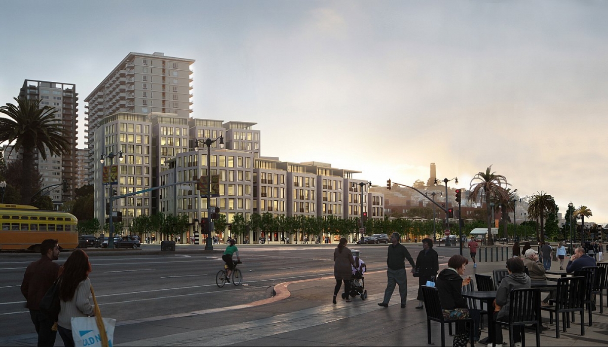
Photo courtesy of 8 Washington
WHAT: 3.2 acres, mixed-use development | WHERE: San Francisco | DEVELOPERS: Pacific Waterfront Partners | STATUS: Rejected by voters, project was canceled | COST: Estimated $200 million
S.F. Ferry Terminal Expansion
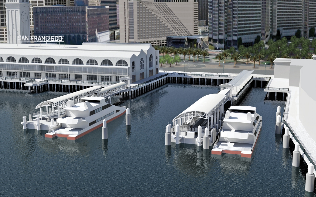
Photo courtesy of San Francisco Bay Ferry
WHAT: 3 acres of ferry gates | WHERE: San Francisco | DEVELOPERS: WETA | STATUS: Begins May 2017.Construction to be completed by 2019. | COST: $80 million (First of two phases
This project would demolish Pier 2 and build three new gates between Pier 1 to the north and Pier 14 to the south, while creating a new plaza south of the Ferry Building. DEVELOPERS plan to raise the plaza and deck structures to make them “resilient to expected sea level rise conditions over at least a 50-year time frame, the assumed design life of the project.” Additional strategies to keep the Ferry Terminal viable until 2100 will also be incorporated
Treasure Island & Yerba Buena Island
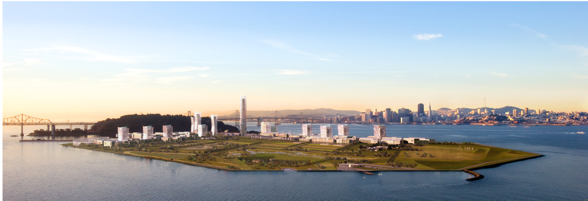
Photo courtesy of Treasure Island SF Bay
WHAT: 46- acre, mixed-use development | WHERE: San Francisco | DEVELOPERS: Treasure Island Community Development, Lennar Urban, Wilson Meany | STATUS: Demolition began in February 2016; first subphase wrapping up. Geotechnical work on Treasure Island will begin in summer 2017. | COST: $3.5 billion to $5 billion
Treasure Island (367 acres) will see 8,000 new homes, up to 550,000 square feet of commercial, office and retail space, and up to 500 hotel rooms, plus 300 acres of parks and open space. On Yerba Buena Island (94 acres), contractors are mobilizing to begin building water reservoirs and roadways/utilities. Development plans include raising the perimeter of Treasure Island to protect against an initial 3 feet of sea level rise, plus an adaptive management plan and a project-generated funding stream to provide for greater adaptations as necessary in the future
Hunters Point Shipyard & Candlestick Point
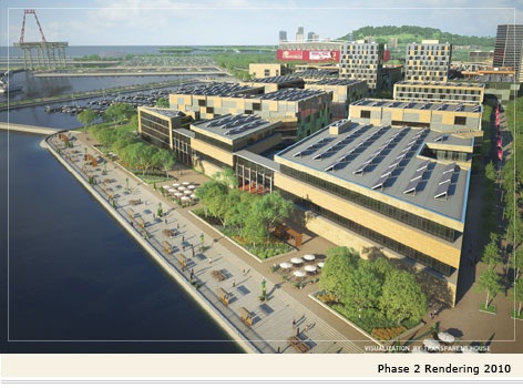
Photo courtesy of the City and County of San Francisco, Office of Community Investments and Infrastructures Hunters Point Shipyard
WHAT: 750 acres, mixed-use development | WHERE: San Francisco | DEVELOPERS: Five Point | STATUS: Second phase under development | COST: Undetermined
The first 88 townhomes and condos opened in 2014. Next up will be 12,100 affordable, workforce, and market-rate homes across the shipyard and Candlestick Point. The shipyard site will include 350 acres of parkland and a 300 slip-marina.
Burlingame Point
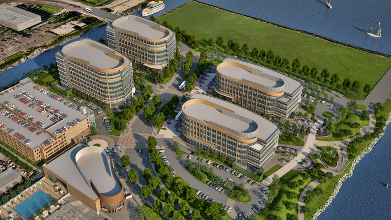
Photo courtesy of Burlingame Point
WHAT: 18-acre, mixed-use development | WHERE: Burlingame | DEVELOPERS: H&Q Asia Pacific, Genzon Property Group | STATUS: Broke ground in early 2017 | COST: Undetermined
The bayfront office project is to include 767,000 square feet of office and life-science space in five buildings ranging from two to eight stories. DEVELOPERS stated buildings in the floodplain would remain dry if the bay crests 7.1 feet above current levels
Lincoln Centre Campus
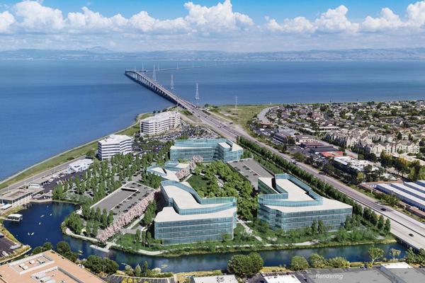
Photo courtesy of BioMed Realty Trust
WHAT: 20 acres, mixed-use development | WHERE: Foster City | DEVELOPERS: BioMed Realty Trust Inc. | STATUS: Pre-construction; ground not broken | COST: $149 million (estimated)
The Lincoln Centre campus will include three new buildings totaling 595,000 square feet of office, lab and manufacturing space.
Redwood City Saltworks
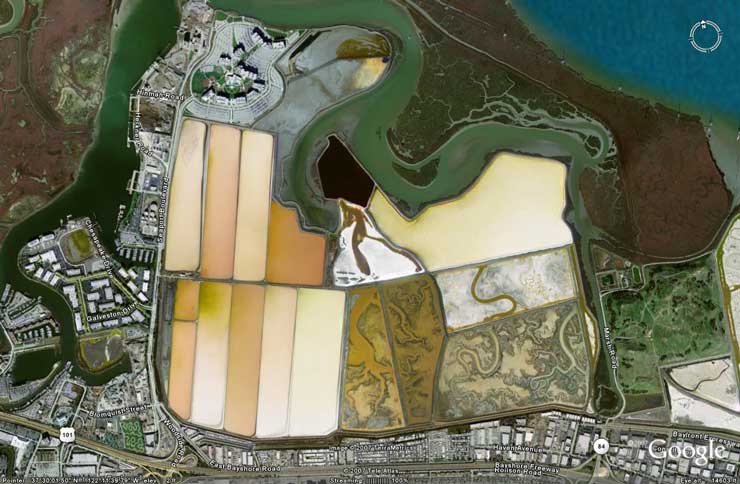
Photo courtesy of Google
WHAT: 1,433-acre, residential | WHERE: Redwood City | DEVELOPERS: DMB Pacific Ventures | STATUS: Withdrawn | COST: Unknown
While the original plan would have brought up to 12,000 new homes to Cargill industrial salt ponds, the developer’s attorney said the “50/50 Plan” is no longer being pursued. “Beyond that, salt-making operations continue and there is no further update.
Crossing 900
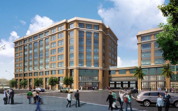
Photo courtesy of Hunter/Strom Properties
WHAT: Mixed-use development | WHERE: Redwood City | DEVELOPERS: Kilroy Realty Corp., Hunter/Storm Properties | STATUS: Completed in early 2017 | COST: Undetermined
The corporate headquarters for cloud-storage company Box Inc. consists of about 334,000 square feet, and up to 5,000 square feet of retail. The first phase of the two-building project — 226,000 square feet of office space — was occupied in 2015, and the second 108,000 square feet space was completed in the first quarter of 2017. The Redwood City Downtown Precise Plan says a “limited portion” of this development zone is vulnerable to 4.6 feet of sea rise, but stresses “uncertainty” in climate predictions.
Pete’s Harbor/ Blu Harbor
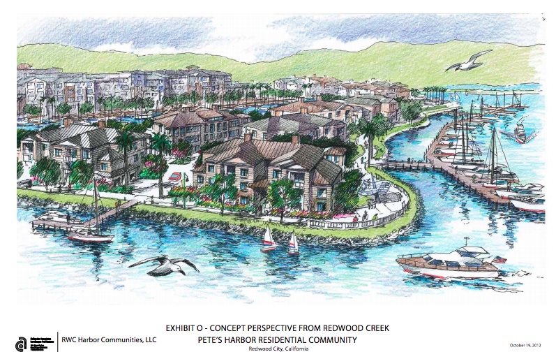
Photo courtesy of the Redwood City Planning Department
WHAT: 14 acres, residential | WHERE: Redwood City | DEVELOPERS: RWC Harbor Communities | STATUS: Under construction | COST: $76 million
First residential units available April 2017. The development plan would include at least 411 homes in addition to a 45- to 65-slip marina. The 2003 environmental statement predicted 1.3 feet of sea level rise by 2036 for the project and the surrounding area
Facebook West
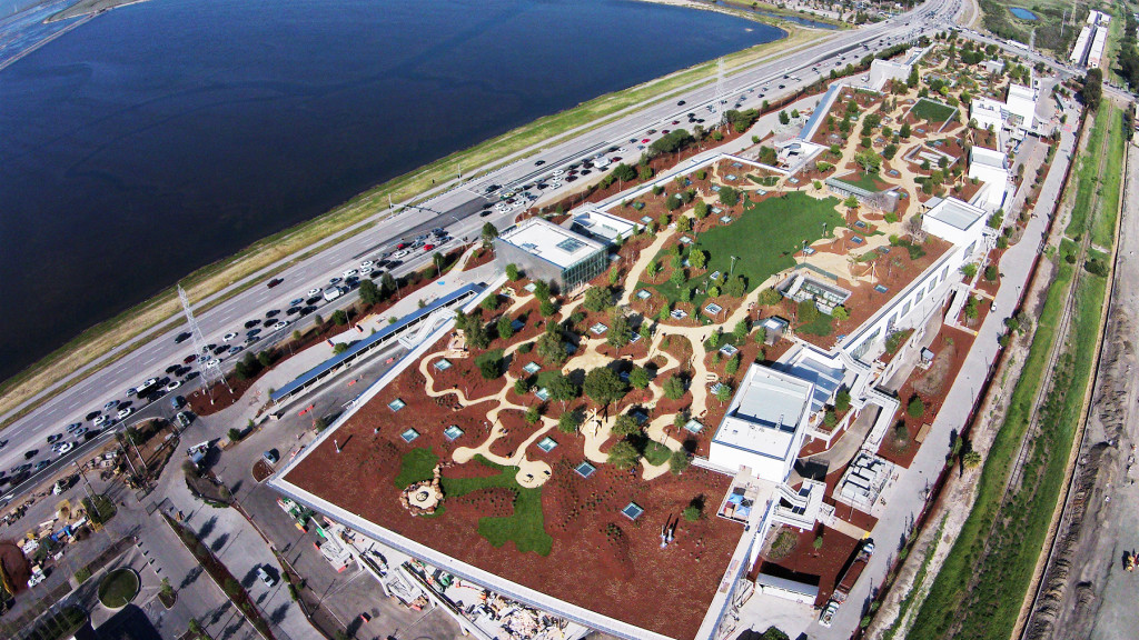
Photo courtesy of Matt Harnack / Facebook
WHAT: 22-acre corporate headquarters | WHERE: Menlo Park | DEVELOPERS: Gehry Partners | STATUS: Completed in March 2015 | COST: Undetermined
The 430,000-square-foot structure, known as “Building 20,” was designed by world-renowned architect Frank Gehry.
North Bayshore Development Area
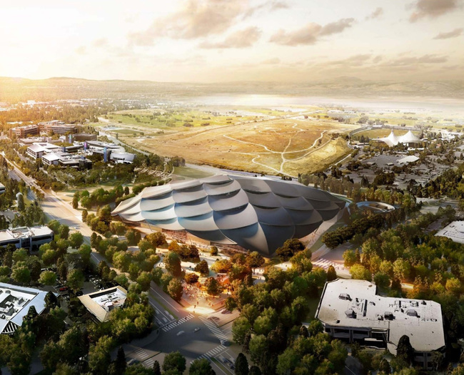
Photo courtesy of Google, Big / Heatherwick Studio
WHAT: 650 acres, mixed-use development | WHERE: Mountain View | DEVELOPERS: Many | STATUS: Awaiting approval | COST: Undetermined
Since the City of Mountain View awarded LinkedIn 1.4 million square feet of its 2.2 million-square-foot location, Google has emerged with an 18.6-acre site, through a property swap, allowing both tech giants to move forward with development plans in Mountain View and Sunnyvale. Mountain View officials said they are working on a revision to the North Bayshore Precise Plan that will study up to 9,850 residential units, in addition to approximately 3.4 million square feet of office space. The city council will consider the revised Precise Plan in June 2017
Google Moffett Federal Airfield
Photo courtesy of NASA
WHAT: 1,000 acres, mixed-use development | WHERE: Mountain View | DEVELOPERS: Planetary Ventures | STATUS: Began testing on Hangar One in 2016 | COST: $1.16 billion (estimate)
In 2016, Google began testing methods to purge toxic contaminants from the Hangar One as part of its plan to restore the giant iconic dome. Google has a 60-year lease with NASA.
Google Moffett Place Campus
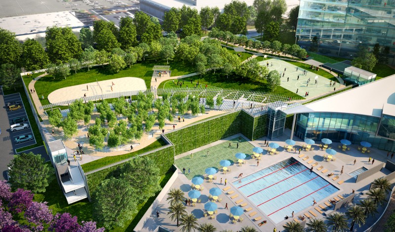
WHAT: 55-acre, mixed use development | WHERE: Sunnyvale | DEVELOPERS: Jay Paul Co. | STATUS: Under construction. Estimated completion April 2020 | COST: Undetermined
Google bought six, eight-story buildings totaling 1.9 million square feet located along Highway 237 near Highway 101 in Sunnyvale. The first phase started with the buildout of three buildings in 2013. Infrastructure work on the second half began in 2015. The draft environmental report states people or structures would not be exposed to injury or loss as a result of flooding.
Centennial Gateway
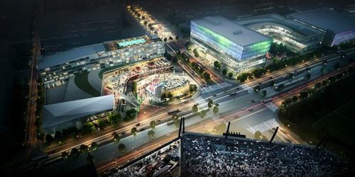
Photo courtesy of the Montana Property Group
WHAT: 8.4-acre, mixed-use development | WHERE: Santa Clara | DEVELOPERS: Montana Property Group., others | STATUS: Construction began 2016-Slated to open 2017 | COST: Undetermined
Montana’s project would include two hotels, up to 400,000 square feet of office, and 150,000 square feet of retail plus a Montana-operated restaurant. The environmental review is not yet public
Alameda Point Site A
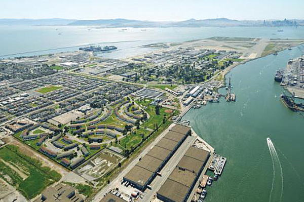
WHAT: 68-acre, mixed-use development | WHERE: Former Naval Air Station Alameda | DEVELOPERS: Alameda Point Partners | STATUS: Construction 2016-2029: Moving through planning board review | COST: Undetermined
The project would bring up to 800 homes — 25 percent of them designated affordable; 600,000 square feet of commercial-retail space in new or rehabilitated buildings; a new ferry terminal; and 15 acres of parks and open space. The project is being built in three five-year phases.
Brooklyn Basin
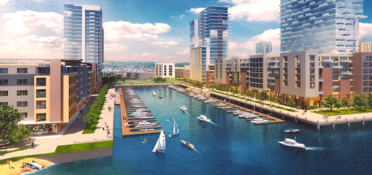
Photo courtesy of Signature Development Group
WHAT: 65-acre, mixed-use development | WHERE: Oakland | DEVELOPERS: Signature Development Group, Zarsion Holdings Group, Reynolds & Brown | STATUS: Construction to begin in spring 2017 | COST: $1.5 billion (estimated)
Construction of first building of the 241-unit mixed-use residential project is to start April 2017, with completion scheduled for the first half of 2019. Construction of the 8-acre Shoreline Park is to begin April/May 2017, with the same timetable for completion
Oakland Army Base
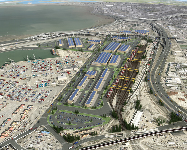
Photo courtesy of California Capital & Investment Group
WHAT: 360-acre, mixed-use development | WHERE: West Oakland | DEVELOPERS: California Capital & Investment Group, Prologis, portion of the former OAB, Port of Oakland | STATUS: Phase I | COST: $1.2 billion (estimate) for the two-phase redevelopment project on parcels of the former base owned by the city and the Port of Oakland
DEVELOPERS said some of the land on the city’s portion of the Oakland Army Base sits on dredged bay sediment and is still settling, which would be expected any time there is development in this area. Engineers working on a portion of the City of Oakland OAB property in Phase I would “densify” the soil and raise it at least 1.3 feet. Completion of initial phase is slated for 2018-2019
Jack London Square
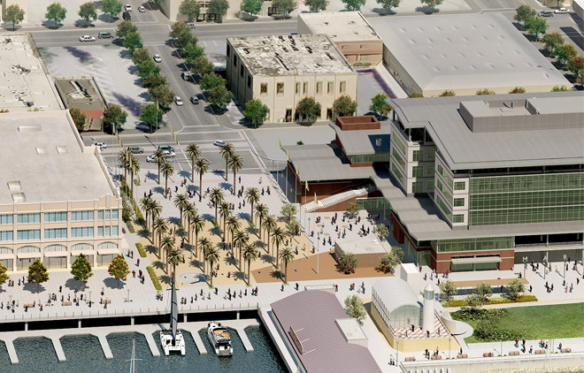
Photo courtesy of Ellis Partners LLC
WHAT: 12-acre, mixed-use development | WHERE: Oakland | DEVELOPERS: Jack London Square Ventures, CIM Group | STATUS: No response from DEVELOPERS | COST: Undetermined
CIM Group bought six buildings, and two development parcels that make the 12-acre Jack London Square mixed-use development site in downtown Oakland. The site consist of 243,000 square feet of office space, 191,000 square feet of retail, in addition to a 250-room hotel and a 665-unit residential tower. A recent update to the environmental statement claims no significant flooding risk but does not detail its methodology
San Leandro Shoreline
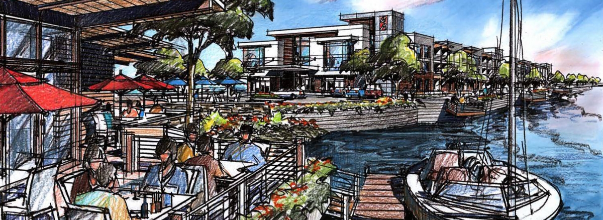
WHAT: 75-acre, mixed-use development | WHERE: San Leandro | DEVELOPERS: Cal-Coast Slated to break ground summer 2017 | COST: Undetermined
The site consist of 52 acres of land and 23 acres of water-surface land. The development has taken 10 years, and once completed would consist of a 200-room hotel, up to 400 homes, 150,000 square feet of offices, a conference center, restaurants, library, amphitheater and recreational space with an artificial beach.
A final environmental review acknowledges that “the project would place housing within the 100-year floodplain and within areas subject to sea level rise/coastal high hazard.” However, “the current FEMA firm panels are undergoing revisions and it is possible that no portions of the Project site will be within the 100-year floodplain when the project is scheduled to start construction.” In addition, the project would be designed to adapt to sea level rise projections and would include “appropriate design standards for building construction to protect structures from sea level rise, such as including elevated grades or floodable development, hard structures such as seawalls and bulkheads, and/or soft structures such as Low-Impact Development (LID), green infrastructure, detention basins, mini- floodplains, biofiltration, and stormwater parks.”
Data Sources
Sea level rise: Projections for San Francisco flooding are from U.S. Geological Survey LiDAR data from 2011, using sea rise scenarios projected by the San Francisco Public Utilities Commission.
Total flood estimates are approximations; the estimate of 3.4 feet of storm surge is a baywide average. This map incorporates a dynamic computer model from Our Coast, Our Future, showing that floods can vary by location.
Outside San Francisco, these projections are based on metric elevations, which we converted to feet to provide the best match for San Francisco’s scenarios. (See the interactive version: ourcoastourfuture.org.)
Different bay-wide flooding models using ocean dynamics have been produced by FEMA, the U.S. Geological Survey, the Bay Conservation and Development Commission and the nonprofit research group Climate Central.
Development: Information about projects in San Francisco comes from the Planning Commission, Department of Building Inspection and Port of San Francisco. Baywide maps derived from environmental impact reports, developer websites, and news articles and maps in the San Francisco Business Times, Silicon Valley Business Times and San Francisco Chronicle. Areas are approximate, calculated using the Spatial Analysis toolbox in ArcMap. Some elevations have changed due to construction since the last aerial elevation survey.
